
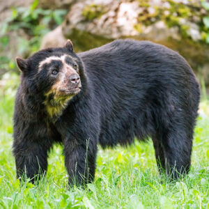
This full day is designed for travelers who are seriously interested in Andean Spectacled Bear and conservation, using the Papallacta / Reserva Ecológica Cayambe-Coca / Guango region as a natural laboratory.
We focus only on Andean Bear—one of the most iconic and threatened mammals of the Northern Andes. While sightings are never guaranteed, this region offers real chances thanks to the connectivity between páramo, shrublands, forest edges, and cloud forest corridors.
The experience combines patient scanning from strategic viewpoints, slow tracking walks along páramo–forest ecotones, and a strong interpretation component: bear ecology, feeding behavior, movement patterns, threats, and local conservation efforts.
Important: This is a tracking & conservation day, not a “guaranteed-bear” tour. The value of the day is in the search, the signs, and the understanding of the bear’s world.
Early departure from your hotel. While driving up, your guide introduces the Andean Bear: distribution, behavior, diet, threats, and why this region is important for the species.
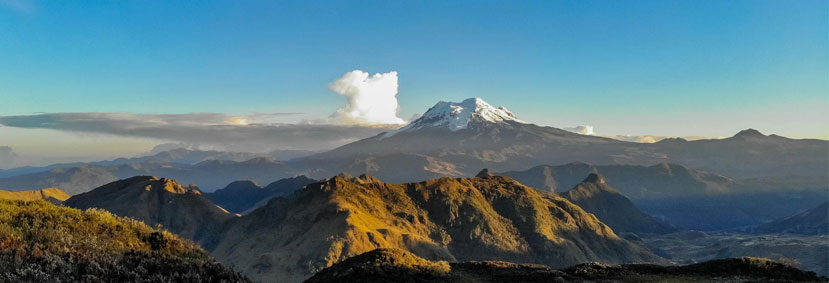
We begin at Virgen Pass, using strategic viewpoints to scan forested slopes, ravines, and páramo–forest edges where bears may feed or move.
Here we combine:
- Long scanning sessions from safe vantage points across likely movement routes.
- Short, slow walks along tracks and edges to look for bear signs:
- broken bromeliads / disturbed vegetation
- trails and movement corridors
- marked trees or rub sites (when present)
Your guide constantly balances fieldcraft and safety: keeping good distance if a bear is seen and avoiding dense, closed terrain that could lead to close encounters.
Even if we do not see a bear, the goal is that you learn to read the landscape like a tracker—understanding where and why bears move, feed, and rest.
Possible supporting wildlife: Andean Fox, White-tailed Deer, Andean Guan, and a variety of high-Andean birds.
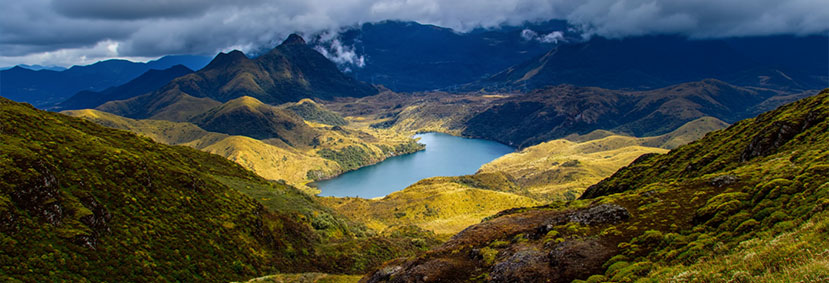
We start from the Reserva Ecológica Cayambe-Coca control point and hike toward Laguna Baños, moving through classic páramo landscapes and ecotone zones.
Along the hike we will:
• Stop frequently for silent scanning of slopes and forest edges.
• Search for fresh feeding signs and bear-use indicators.
• Interpret tracks, droppings, and habitat features that reveal movement routes.
• Discuss how seasonality, weather, and human pressure influence bear behavior.
Operational note: access conditions, trail status, and time on trail depend on weather and park guidance. We adapt in the field to prioritize safety and the best wildlife chances.
12:30–13:30 – Lunch in Papallacta
We stop in Papallacta for lunch (local restaurant/lodge depending on your program). Timing remains flexible: if bear activity is strong, we adjust to stay in the field when it matters most.
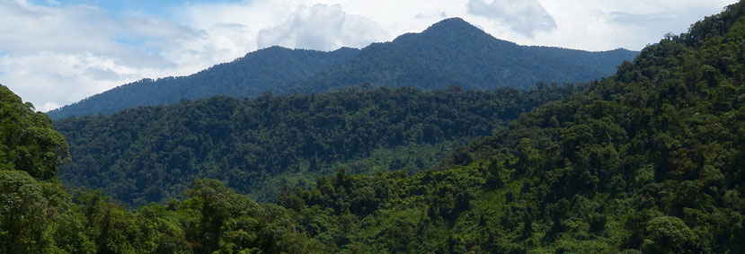
We visit the Guango area on the eastern slope to explore cloud forest edges and viewpoints.
Here we may:
• Walk quiet forest trails and edges used by wildlife.
• Check muddy sections and natural corridors for signs (bear-focused).
• Use safe openings/clearings to scan slopes across the valley.
Interpretation here emphasizes connectivity: how bears use altitudinal gradients and corridor landscapes between high Andes and the eastern slope.
We begin at Virgen Pass, using strategic viewpoints to scan forested slopes, ravines, and páramo–forest edges where bears may feed or move.
Here we combine:
- Long scanning sessions from safe vantage points across likely movement routes.
- Short, slow walks along tracks and edges to look for bear signs:
- broken bromeliads / disturbed vegetation
- trails and movement corridors
- marked trees or rub sites (when present)
Your guide constantly balances fieldcraft and safety: keeping good distance if a bear is seen and avoiding dense, closed terrain that could lead to close encounters.
Even if we do not see a bear, the goal is that you learn to read the landscape like a tracker—understanding where and why bears move, feed, and rest.
Possible supporting wildlife: Andean Fox, White-tailed Deer, Andean Guan, and a variety of high-Andean birds.